
 Idaho News 6
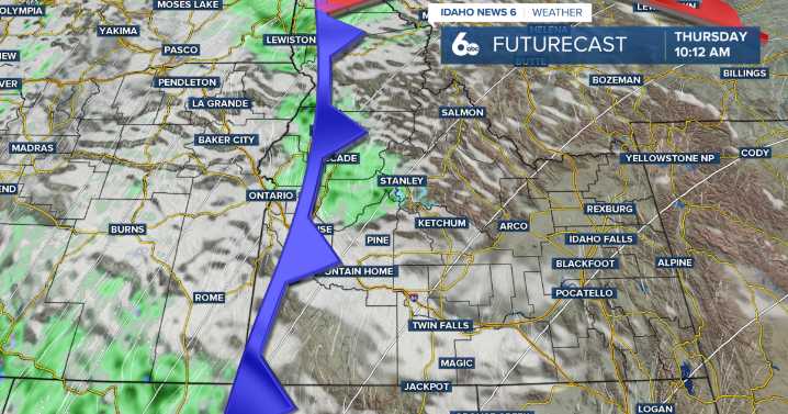
Good Morning, Idaho!
Mild and dry conditions persist through Wednesday afternoon as a ridge of high pressure remains in place. This ridge has also introduced a southwesterly flow, which will generate breezy conditions on Wednesday and Thursday. Temperatures peak on Wednesday, running 10–15 degrees above average for this time of year.
A noticeable shift in pattern arrives on Wednesday evening. A high-amplitude trough strengthening along the West Coast will move inland, bringing increasing clouds and the first chances of showers. A 15–30% chance of precipitation develops across southeast Oregon and the central Idaho mountains late Wednesday night. Snow levels will begin high—around 8,000–9,000 ft as the first showers arrive.
By Thursday, winds strengthen further ahead of the front, and is

 FOX 51 Gainesville Crime
 Battle Creek Enquirer
 AccuWeather Severe Weather
 Eyewitness News 3
 Daily Voice
 WCNC Charlotte Weather
 Newsday
 WFMJ-TV Politics
 Ocala Star-Banner
 OK Magazine