
 USA TODAY National
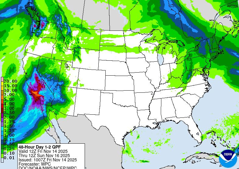
Southern California is bracing for an atmospheric river that could bring flash floods to the region, triggering evacuation warnings in steep terrain and areas ravaged by wildfires earlier this year.
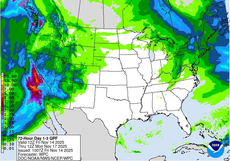
A large storm that lashed Northern California this week, triggering a ground stop at San Francisco's major airport and flooding parts of Santa Cruz, is expected to slow down as it moves over Southern California into the weekend. The storm is forecast to unleash torrential rain over Southern California and heavy snow across the Sierra Nevada mountains.
The National Weather Service said 2 to 5 inches of rain are expected through Sunday, Nov. 16, with some areas seeing as much as 6 inches of rainfall. Federal forecasters issued flood watches across much of Southern California.
"Excessive rainfall is the primary, life-threatening concern, with widespread flash flooding and debris flows likely across the vulnerable burn scar areas of Santa Barbara, Ventura, and Los Angeles Counties," the weather service said on Friday, Nov. 14.
City officials in Los Angeles issued evacuation orders and warnings for nearly a dozen locations impacted by recent wildfires, including the Palisades and Eaton blazes that torched vast swaths of Los Angeles County.
Los Angeles Mayor Karen Bass told residents that the storm's peak is expected on the evening of Friday, Nov. 14, and will continue the next day. She asked that people sign up for real-time safety updates and prepare to evacuate if they're near burn scars.
Meanwhile, winter storm warnings have been issued for the Sierra Nevada, where more than a foot of snow is expected along with powerful winds. The heavy snow could lead to low visibility, making for dangerous travel conditions, the weather service said.
Weather warnings active across central and southern California
How wildfires can worsen flooding
It has been a historic year for wildfires in Southern California, making the risk of flooding all the more dangerous.
Under normal conditions, soil is a reliable absorbent, meaning it would take more rain to cause flooding. But burned soil can be as water-repellant as pavement, leading to more flash floods and debris flows, according to the weather service.
In the first months of the year, Southern California saw some of its worst wildfires in modern history. The Eaton and Palisades wildfires, which burned across Los Angeles County, claimed at least 31 lives and torched thousands of homes.
Those living near the 58 square miles of land eviscerated in the two wildfires were under evacuation warnings on Nov. 14 as the first rains of the atmospheric river arrived.
Contributing: Doyle Rice
This article originally appeared on USA TODAY: Atmospheric river prompts flood watches, evacuation warnings in Southern California
Reporting by Christopher Cann, USA TODAY / USA TODAY
USA TODAY Network via Reuters Connect

 LiveNOW from FOX Politics
 FOX 11 Los Angeles
 The Weather Channel
 KSNB Local4 Central Nebraska
 FOX Weather
 Daily Voice
 ABC 7
ABC 7 The Pride LA
 WHAS 11
 WYMT
WYMT The Texas Tribune Crime