
 WMTV NBC15
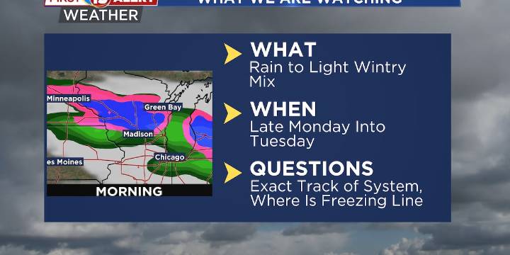
A cold front will drop temperatures back down near average on Sunday
Wintry mix will be possible late Monday into Tuesday
Next best chance of rain arrives late next week
MADISON, Wis. (WMTV) - The warm-up continues! Temperatures will remain above average today in the 60s for most areas across southern Wisconsin. Breezy southwesterly winds this morning will shift to gusty northwesterly winds through the afternoon and evening as a secondary low moves across Lake Superior and northern Lake Michigan. Although most of the area will stay dry, there is a small chance for a band of sprinkles or light rain late this morning across east-central Wisconsin. Click Here for Interactive Radar
What’s Coming Up...
A cold front will move through the state later today and usher in a much colder Canadi

 Daily Voice
 Siskiyou Daily News
 NBC Connecticut
 FOX 11 California
 CBS Philly
 The Traverse City Record-Eagle
 The Weather Channel
 @MSNBC Video
 RadarOnline