
 ABC News AU
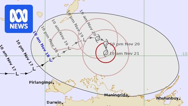
A tropical low sitting off the Northern Territory coast is forecast to become a category two cyclone by Thursday, the Bureau of Meteorology (BOM) says.
The BOM issued its first forecast track map for the system on Tuesday morning, indicating the tropical low – currently sitting north of the Tiwi Islands – will continue to head in a north-east direction over the next 48 hours.
By 10pm on Thursday, the system is expected to become a category two cyclone and head south towards the NT coastline, north of west Arnhem Land. Loading...
BOM forecaster Jonathan How said the system had begun to develop circulation.
"Over the next few days, as shown in the track map, it will start to move towards the north-east over the sort of Timor-Arafura seas and gradually start to strengthen," he said.
"

 CNA Entertainment
 5 On Your Side Sports
 AlterNet