
 WAND TV
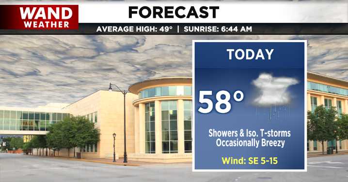
DECATUR, IL. (WAND) - Happy Tuesday! We’ve got a wet start to the day as widely scattered showers and storms from overnight continue early this morning.
A few thunderstorms may still be rolling through by midday, and we have a chance for it to be strong to severe. Our primary concern will be hail up to 1 inch in diameter. These severe chances exist mainly south of I-72.
By this evening, most are drying out with mostly cloudy skies remaining. Temperatures will top off in the mid to upper 50s with lows tonight limited to the low 40s under cloudy skies.
We get a cloudy and quiet break for tomorrow, but rain returns to the forecast by the end of the workweek.

 RiverBender East Saint Louis
 WSIL-TV
 WLFI News 18
 The Daily Beast
 NBC Chicago
 New York Post
 People Top Story
 Week | 25 News Now
 AlterNet
 Rolling Stone
 Atlanta Black Star Entertainment