
 SIAdvance
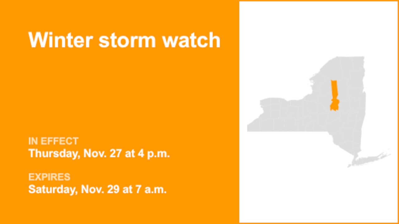
On Monday at 12:20 p.m. a winter storm watch was issued by the National Weather Service valid from Thursday 4 p.m. until Saturday 7 a.m. for Herkimer County.
The weather service describes, "Heavy lake effect snow possible. Total accumulations up to 10 inches within the most persistent lake effect bands. Winds could gust as high as 35 to 40 mph Thursday and Friday."
"Visibilities may drop below 1/4 mile due to falling and blowing snow. Plan on slippery road conditions. The hazardous conditions could impact the Thanksgiving Holiday travel on Thursday as well as the Friday morning and evening commutes," describes the weather service. "Monitor the latest forecasts for updates on this situation. During lake effect snow, the weather can vary from bands of locally heavy snow to dry weather just

 Syrancuse.com
 The Bay City Times
 Daily Voice
 Sault Ste.Marie Evening News
 WCBI-TV
 WAFB
WAFB Jackson Citizen Patriot
 KPLC
KPLC Newsmax TV
 CBS News