
 KIOW
KIOW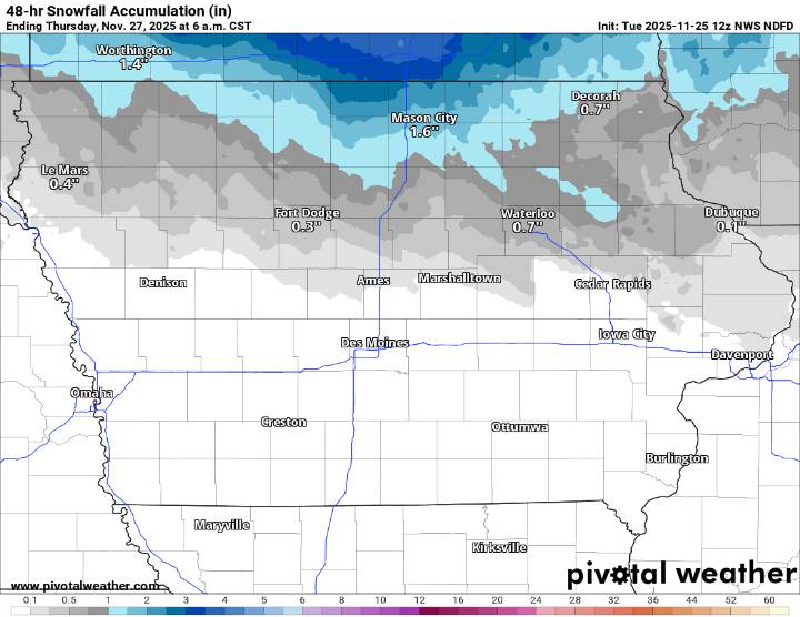
A round of light snow is projected to move across northern Iowa through Wednesday morning, with accumulations expected to remain on the lighter side for most communities. According to the latest National Weather Service guidance, the bulk of the snowfall will fall across the northern tier of the state, including the KIOW listening area.
Forecast models show Mason City potentially receiving around 1.6 inches , with Worth County and areas near the Minnesota border picking up between 2 and 4 inches . Farther south, snow amounts taper off quickly. Forest City, Garner, and surrounding communities could see 1 to 2 inches , while Fort Dodge is projected at around 0.3 inches . East of I-35, Waterloo may receive close to 0.7 inches , with very light totals farther southeast.
Communities

 Daily Voice
 Detroit News
 CNN Climate
 AccuWeather Severe Weather
 WMTV NBC15
 The Oregonian Public Safety
 WISC-TV Channel 3000
 Associated Press US News
 KOLD Tucson
 The Conversation