
 WLFI News 18
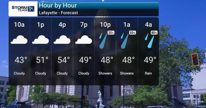
We're starting the week off with that familiar dense morning fog, especially in our southwestern areas, but we'll see those clouds thicken up as a system moves in bringing rain chances tonight and through much of Tuesday. We're expecting periods of showers.
By Wednesday, a significant pattern shift is on the horizon as a strong cold front sweeps through. This will usher in much colder, arctic air, making Wednesday a windy day with temperatures plummeting from the low 50s into the upper 30s very quickly.
We're forecasting gusty winds out of the west and northwest, potentially exceeding 40 mph, and wind chill values could drop into the teens. This much colder-than-normal air will stick around through Thanksgiving and Friday, keeping highs struggling to reach the freezing mark and wind chil

 WYFF News 4
 WREX
WREX KOMU 8
 Newsweek Top
 NPR
NPR The Daily Beast
 CNN
CNN