
 The Shaw Local News State
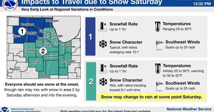
Northern Illinois could see its first high-impact winter storm of the season this weekend, with the National Weather Service warning of the potential for more than 6 inches of snow Saturday into Saturday night.
While the NWS stressed that exact snowfall totals and the precise track of the storm remain uncertain, confidence is growing that much of the region will experience accumulating snow during one of the busiest travel weekends of the year.
Areas northwest of a Chicago-to-Mendota line currently have the highest potential for heavier totals, with typical snow ratios that could support amounts over 6 inches. In these areas, snowfall rates may reach 1 inch per hour at times. Farther south and east – including Joliet and Kankakee – temperatures may briefly rise near or above freezing Sat

 Daily Voice
 Detroit News
 CNN Climate
 AccuWeather Severe Weather
 WMTV NBC15
 The Oregonian Public Safety
 Associated Press US News
 WISC-TV Channel 3000
 KCTV5 News Kansas Sports