
 WWSB
WWSB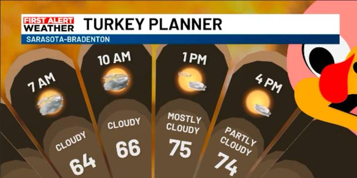
SARASOTA, Fla. (WWSB) - Say good bye to temperatures way above normal, at least for a few days. A cold front is moving through. It started aproaching the area last night and will continue into today as it pushes south and clears the Suncoast. As the day goes on, a fresh batch of chilly northern air will spill in, putting a cap on afternoon highs. While morning temperature started in the mid to upper 60s, the afternoon high will not exceed the mid-70s. Cooler afternoon highs will be acompanied by a brisk wind out of the north. Gusts could be as high as near 20mph this evening, addding an extra chill to the air.
Friday will be the coldest slice of the holiday pie. Lows will dip into the upper 30s along the Nature Coast, with low 50s farther south in our area. Add in a breezy north wind, and

 WNEP
WNEP Newsday
 WESH 2 News
 Bored Panda
 ClickOrlando
 CBS4 Miami
 News4JAX
 The List
 People Crime
 People Human Interest