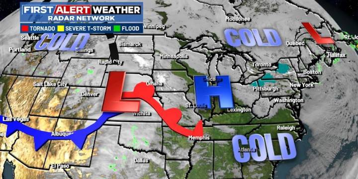
LEXINGTON, Ky. (WKYT) - It’s a frigid Black Friday across the Commonwealth as we track a system in for the weekend.
Rain and some light snow move into western Kentucky early Saturday and spread east from there. Many areas may, at least, start as a few flakes before going over to rain, especially along and south of I-64. Northern Kentucky has the best chance to put a little snow on the ground during this time.
Some flakes will then show up on the back edge of everything as it moves out on Sunday.
The bigger system arrives Monday night and Tuesday and may very well be our first Winter Storm Threat of the season. The models continue to give us a nice storm signal, but they are, as expected, really struggling with the details. All modes of precipitation may show up across Kentucky.
A Firs

 WKYT
WKYT

 WYMT
WYMT Local News in Illinois
 The Atlantic
 America News
 Associated Press US News
 CBS Sacramento Dixon News
 23ABC News Bakersfield
 People Human Interest
 AlterNet