By Joe Lombardi From Daily Voice
A potent storm targeting the Northeast could bring the first widespread snow accumulations of the season, with some areas expecting up to a half-foot or more.
After a round of rain sweeps through in the afternoon and early evening on Sunday, Nov. 30, National Weather Service meteorologists say the rain will quickly end from west to east on Sunday night.
But the break will be brief. Forecasters say the new storm system will move in by Monday evening, Dec. 1, setting the stage for widespread snow, ice, and a wintry mix on Tuesday, Dec. 2, with rain farther south and along the coast.
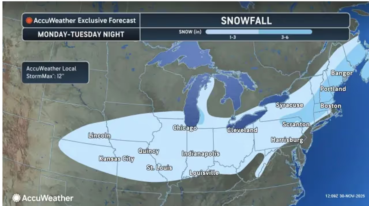
By Tuesday, most of the Northeast — including Pennsylvania, New York, northern New Jersey, and New England — will see snow or a mix of snow and sleet on the storm’s colder side. Other areas will get mostly rain.
According to AccuWeather, most places in the path of the storm can expect 1 to 6 inches of snow. But a “pocket of heavier snow is possible from the Catskills of New York and the Berkshires of Connecticut and Massachusetts to perhaps southeastern Maine.” In those areas, localized totals could reach a foot.
The storm is expected to move quickly, which should limit excessive snowfall. Still, roads could turn slippery for a time, especially in northern and western suburbs of big cities like Philadelphia and New York, where snow could linger for several hours.
Forecasters say a fast-strengthening secondary storm off the coast could also bring a blast of cold air down the Hudson Valley, possibly turning rain into more snow for New York City and leading to tricky travel.
Boston is likely to see a mix of snow and rain, with slushy travel possible through Tuesday night. North and west of the city, heavier snow and more dangerous driving conditions are forecast.
Washington, DC, is expected to see all or mostly rain on Tuesday.
Precipitation should wind down Tuesday night, with a return to sunny but brisk weather on Wednesday, Dec. 3.
“Cold is forecast to dominate the weather pattern from the Plains to much of the East during the first 10 days of December,” AccuWeather Senior Long-Range Meteorologist Joe Lundberg said.
Check back to Daily Voice for updates.

 Daily Voice

 Massillon Independent
 The List
 Nola Sports
 Raw Story