
 WLFI News 18
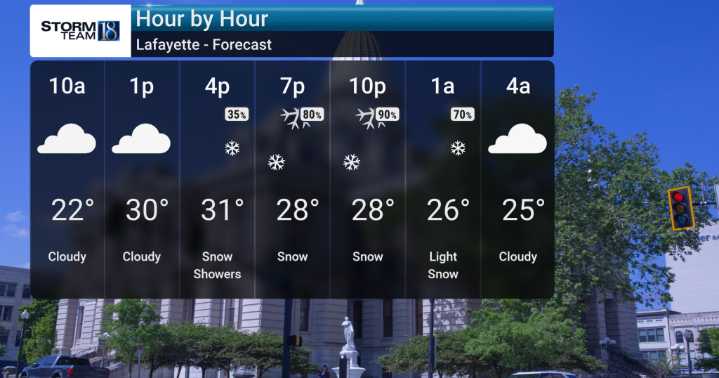
Good morning! We're looking at snow showers developing this afternoon, becoming more widespread and heavier later this evening and overnight. Accumulations of 1 to 3 inches are anticipated across much of the region, though we could see higher amounts in localized areas due to potential snow banding.
As we move into Tuesday, the snow will taper off, and we'll see a return to a mix of clouds and some sunshine. However, the cold air really starts to settle in. We'll be monitoring frigid overnight low temperatures, potentially dipping into the teens, with wind chills making it feel even colder, falling into the single digits in some northern areas by Wednesday night and Thursday night.
We're forecasting snow showers to return later on Wednesday, ahead of another arctic push. Looking ahead to

 Local News in New Jersey
 Daily Voice
 WLWT
WLWT New York Post
 KSLA News
 The Conversation
 The List
 RadarOnline