
 ClickOrlando
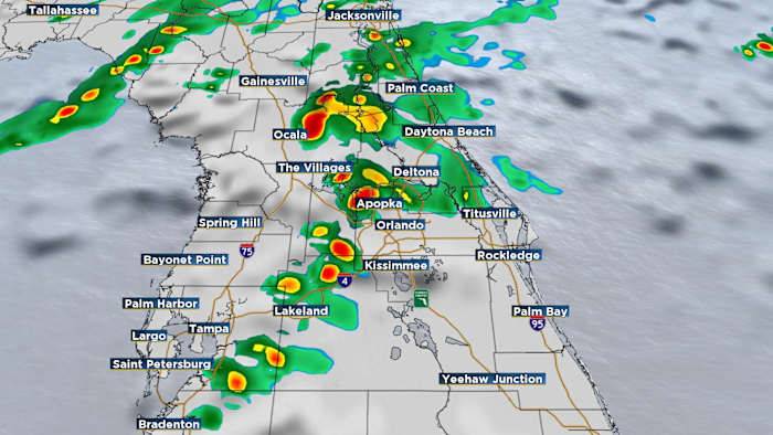
ORLANDO, Fla. – Get ready for some ups and down in the Central Florida forecast.
The next system Tuesday, a cold front, brings the best chance for rain to Central Florida in weeks.
Expect a warm and cloudy start Tuesday with a stray shower for the morning commute.
The highest rain chance, and even the shot for a few thunderstorms, arrives late in the morning through the afternoon. Future radar
Rain chances begin along/near I-75 and push toward I-4 closer to lunch. Future radar
Scattered rain chances continue through the middle of the afternoon for the I-95 corridor. Future radar
The air behind this latest front doesn’t have the punch of its predecessors.
Highs Tuesday will be around 80 degrees.
By Wednesday, highs will be in the 60s and 70s after a start in the 50s for most of

 News Collection
 Reuters US Business