
 WSAZ NewsChannel 3
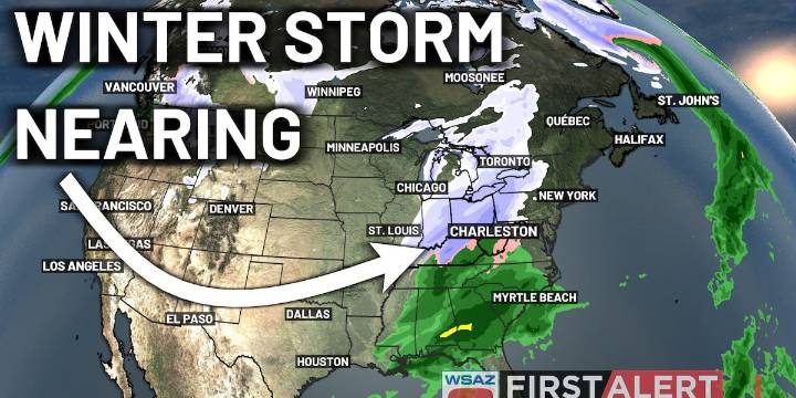
HUNTINGTON, W.Va. (WSAZ) - A winter storm will begin impacting the area tonight, lasting into the morning commute; however, not everyone is expected to see major impacts from this system.
A wedge of warm air will work into much of the lowlands, especially impacting the I-79 and US-119 corridors. With this, expect mostly rain in places like Charleston, Logan, Pikeville, and Sutton. Along I-64 from Grayson to Huntington, light icing with a few inches of snow is to be expected. This is also expected in places like Richwood, Summersville, and Fayetteville.
The heaviest snow is expected in southern Ohio, with 3-4″ of snow from Portsmouth to Athens.
Things dry out as we head into the afternoon and evening. This will last through the end of the week and into the weekend as well. Over the long

 Times West Virginian
 Daily Voice
 The Conversation
 WUSA 9 News
 KSNB Local4 Central Nebraska
 Whittier Daily News
 CNN Climate
 The Daily Beast