
 WWSB
WWSB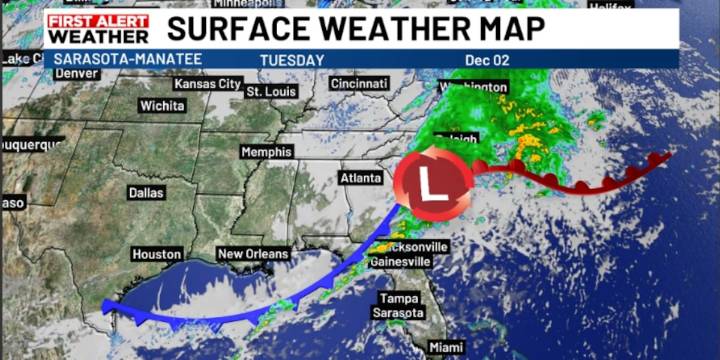
SARASOTA, Fla. (WWSB) -We will start the day with patchy fog across the interior and some low clouds elsewhere. Visibility may be reduced in some areas, so you may wish to allow a bit of extra commute time in the morning.
As the day goes on, attention turns to the next cold front, which is knocking on our door and expected to move through later today and tonight. That front will bring our next round of showers and possibly a few thunderstorms. Nothing dramatic at this point, with the Storm Prediction Center keeping the Suncoast out of the risk for severe weather.
Behind the front, Wednesday shapes up noticeably different. Skies turn clearer, humidity drops, and the air takes on that crisp, cooler feel. Highs will still be comfortably warm, generally in the lower 70s.
We will slowly warm

 News4JAX
 NewsNation Crime
 Florida Today
 WCTV
WCTV WCJB-TV20
 CBS News