
 News Channel 36
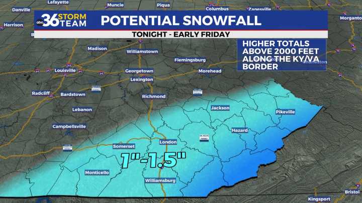
Below average temperatures should remain in place through the weekend It was the same ole song and dance across Central and Eastern Kentucky on Thursday with plenty of clouds and unseasonably cold temperatures. In the wake of a departing frontal boundary, additional cold air drifted into the area so afternoon highs struggled to reach the freezing mark here in the Bluegrass with only mid-30s down south. Unfortunately we aren’t looking at any significant warm-up in the coming days so keep those winter coats handy.
A southern storm system along the Gulf Coast should throw enough moisture northward to squeeze out some light snow across Southern Kentucky into the early hours of Friday. The latest data has increased the wintry weather potential for our southern counties with accumulations look

 The Hill
 The Washington Post
 The Bay City Times
 Valley Central
 CNN
CNN Newsmax TV
 FACTS.NET Culture
 Raw Story
 AlterNet