
 ABC57 News
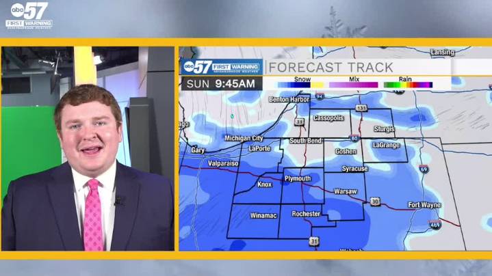
To view this video please enable JavaScript, and consider upgrading to a web browser that supports HTML5 video
Dangerously cold weather awaits you this morning out the door; wind chills reach near negative double-digit values around 6 to 7 AM EST. Our area sees some improvement from this morning later today as highs are expected to reach the mid 20s courtesy of patchy sunshine. Lows will sink to near 20 degrees later tonight with wind chill values in the low teens. A dose of snowy weather on Saturday morning ends as quickly as it started, leaving little more than a trace to kick off the weekend. The heavier and longer-lasting snow begins early Sunday morning and will deposit a blanket 1"-2" across our entire forecast area, once again creating slick conditions and hazardous travel. After

 CBS 58 News
 WCVB-TV Boston
 AccuWeather Severe Weather
 News 5 Cleveland
 Newsmax TV
 Newsweek Top
 CBS News
 Blaze Media
 NBC News
 Crooks and Liars