
As this week's burst of cold, wintery weather is expected to wane on Saturday, more frigid air is on the way for next week. While no record cold temperatures are expected on Saturday and the feels-like temperatures are expected to improve briefly, most will remain seasonably cold and blustery. Afternoon wind chills on Saturday may reach up to the mid-20s for Chicago, mid-30s for New York City, and mid-40s for Washington D.C. Overnight into Saturday morning, places along the 1-95 corridor from Washington D.C. to New York City saw a quick burst of light snow and wintry precipitation. However, this was not enough to accumulate anything more than a light dusting in most places and has already begun to dry out. Some spots from DC to western New Jersey saw measurable snow up to half an inch. Som
As burst of cold air wanes, frigid air is on the way for next week
 ABC News Weather6 hrs ago
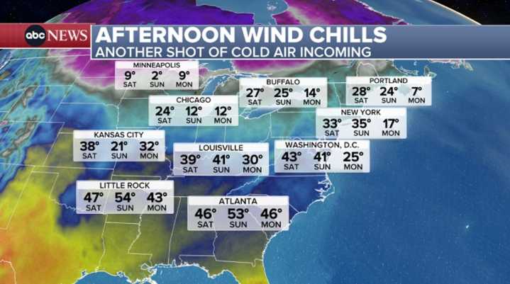
132

 Newsweek Top
 Daily Voice
 WISC-TV Channel 3000
 CBS News
 WTOP
WTOP KETV NewsWatch 7
 Louisville Public Media
 Cover Media