
 WRCB-TV
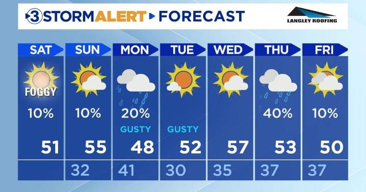
Happy Saturday, everyone!
Tonight's low will be 33 with clear skies. Winds will continue to be calm.
Sunday will be warmer than today at 54 with mostly sunny skies. The low will be above freezing at 41. Rain showers are expected in the late evening hours.
More rain showers will move in on Monday morning. Some flurries may be mixed in with these showers in the mountains. As the system moves east and temperatures drop, freezing rain will be possible in the mountains between Cherokee and Monroe counties. Not much accumulation is expected, but even a little bit of freezing rain can cause slick spots. Sustained winds between 10-15 mph and wind gusts between 15-20 mph are expected with these pockets of rain. Sustained winds and wind gusts will remain this way until Wednesday.
Temperature hig

 Billboard
 RadarOnline
 Cover Media
 WILX News 10
 Screen Rant