
 Denver7 News
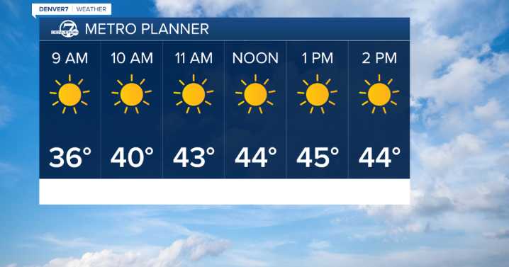
DENVER — After a fast-moving winter storm moved across Colorado’s mountains Saturday, conditions are finally starting to settle down.
Snow is tapering off across the high country, but strong winds gusting up to 55 mph at the higher peaks and passes will continue to blow snow around, keeping travel visibility low in spots.
A weak cold front is sliding onto the plains that could bring patchy fog late tonight, mainly across the eastern and northeastern plains.
Sunday morning could have a few light snow showers above 9,000 ft, with calmer winds.
There will be dry conditions and near-seasonal temperatures, with highs in the low 40s for the Front Range.
Monday will be a touch warmer with highs near the low 50s and dry conditions.
DENVER WEATHER LINKS: Hourly forecast | Radars | Traff

 KCRA News
 ABC 7 Chicago Sports
 AlterNet
 Rolling Stone