
 WSAZ NewsChannel 3
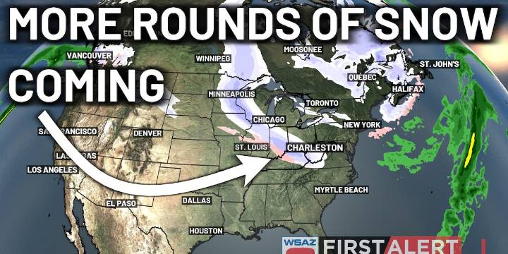
HUNTINGTON, W.Va. (WSAZ) - Our active December pattern is set to continue as all of the ingredients are coming together to keep us in cold air. Snow chances are set to continue over the area, as well, through the end of this week.
The next round of precipitation is expected to move in for Wednesday. This will drive batches of showers, as more warm air is expected to work in with this system. However, areas higher in elevation will begin to see snow mix in on and off throughout the day on Wednesday.
After a brief break on Thursday, another round of snow will be expected to move in for Friday, with likely a thump of snow expected during that morning commute. Some rain may mix in for the afternoon.
After this Friday system, likely the coldest air of winter so far will move in, as overnight

 CBS19 News Crime
 The Oregonian Public Safety
 MyNorthwest
 WCCB Charlotte
 WYMT
WYMT Siskiyou Daily News
 WITN-TV
 KWWL
KWWL KKTV 11 News
 New York Post
 AlterNet