
An ABC News analysis of satellite imagery and tracking data shows the oil tanker seized by the United States off the coast of Venezuela on Wednesday may have manipulated its location data -- an apparent attempt, experts said, to circumvent restrictions imposed by sanctions. The crude oil tanker, named the "The Skipper," according to four people familiar with the operation, was sanctioned by the U.S. in 2022. Digital broadcast signals emitted from the vessel’s transponder and tracked by analytics company Kpler placed the Skipper near Guyana’s offshore between November and December. However, more than a dozen satellite images verified by ABC News confirmed Skipper was in fact operating in waters off the coast of Barcelona, Venezuela, around 550 miles away during this same period. Citing a "p
Satellite images suggest seized tanker 'deliberately' manipulated location data
 ABC NewsJust now
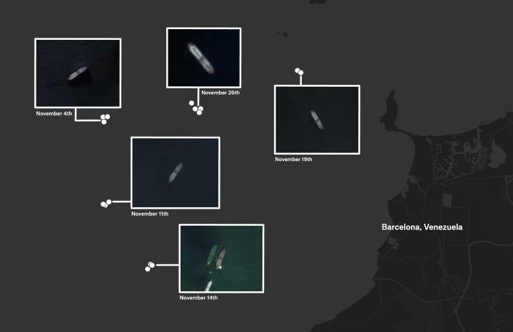
47

 Bloomberg Quicktake
 NEWS10 ABC Sports
 Reuters US Top
 Raw Story
 AlterNet
 The Hill Politics