
 WKYT
WKYT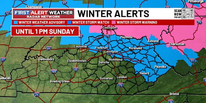
LEXINGTON, Ky. (WKYT) - Our long haul FIRST ALERT WEATHER DAY continues this weekend into Monday as more snow showers arrive this weekend along with some bitterly cold temperatures.
FRIDAY NIGHT: FIRST ALERT WEATHER DAY. Mostly cloudy skies will be with us for this evening, and that will continue into the overnight hours. It will turn very cold with lows in the mid to upper 20s. Watch for areas of black ice to develop overnight into Saturday morning.
SATURDAY: FIRST ALERT WEATHER DAY. Cloudy skies will be around throughout the day with some snow flurries. It will be a cold day, but we will see a range in highs. Northern and central Kentucky will only make the mid to upper 30s, while areas in southern Kentucky climb into the low to mid 40s. More snow makes its arrival during the eve

 Atlanta Black Star Entertainment
 Mediaite
 America News
 ABC 7 Chicago Sports
 The Daily Beast
 NBC News Crime
 The Atlantic
 The Motley Fool