
 The Georgia Sun
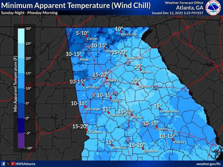
New weather maps released Friday show the cold snap hitting Georgia late Sunday will be sharper and colder than earlier outlooks suggested.
What’s Happening: Updated National Weather Service maps show wind chills dropping into the single digits and teens across much of north and central Georgia late Sunday night into Monday morning.
Wind chills as low as 5 to 10 degrees are possible in parts of north Georgia.
Much of central Georgia will feel temperatures in the low to mid-teens.
What’s Important: This will be the coldest stretch of the season so far, arriving quickly after mild weather Saturday. The rapid drop increases risks for exposed pipes, pets, and people without reliable heat.
The Timeline: Highs reach the 60s Saturday. A strong cold front moves through Sunday, with the

 The Oregonian Public Safety
 KOIN News
 KKTV 11 News
 AccuWeather Severe Weather
 Syrancuse.com
 WIS News 10
 ABC 6 WPVI-TV
 KOMO News
 KETV NewsWatch 7
 Charleston Gazette
 Raw Story