By Joe Lombardi From Daily Voice
As a potentially major winter storm nears, new projections have emerged on snowfall totals and its timing for the Northeast and beyond.
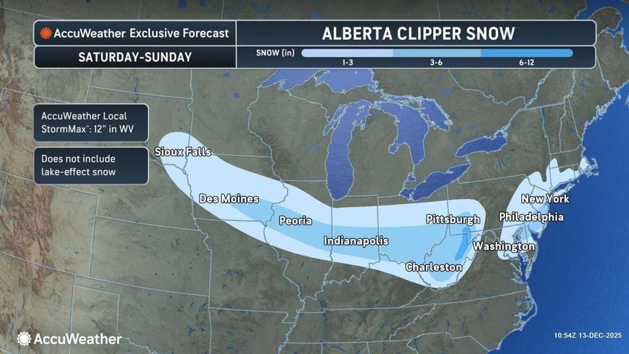
A fast-moving clipper system is set to sweep from the Midwest to southern New England from Saturday, Dec. 13, into early Sunday, Dec. 14, the National Weather Service says.
Snow will begin in the Plains and Midwest before spreading to the East Coast Saturday night, impacting cities along Interstates 70 and 95, according to AccuWeather.
Forecasts call for at least 1 inch of snow across a 1,500-mile stretch. The heaviest amounts — 3 to 6 inches— are expected from eastern Maryland to the Jersey Shore.
In the mountains of West Virginia, western Maryland, and southwestern Pennsylvania, some spots could see up to 12 inches.
Farther north, parts of Long Island could see between 4 and 5 inches of accumulation.
Travelers should expect snow-covered and icy roads to develop quickly, especially along I-70 and I-95. Air travel delays are likely from the Ohio Valley to southern New England, and those attending the Army-Navy football game in Baltimore should be prepared for slick roads afterward.
An Arctic blast will follow the storm, sending temperatures plummeting across the Midwest and Northeast and delivering the coldest air of the season so far. AccuWeather meteorologists say the extreme chill will be brief, however, with warmer temperatures expected before Christmas.
"If it is any consolation, the Arctic blast will leave quickly with the worst conditions only lasting a little over 24 hours," AccuWeather Senior Meteorologist Brett Anderson said. "A significant warmup is in store for much of the central and eastern United States next week."
Check back to Daily Voice for updates.

 Daily Voice


 Eyewitness News 3
 Mediaite
 Raw Story
 DoYouRemember?
 America News