
 cleveland.com
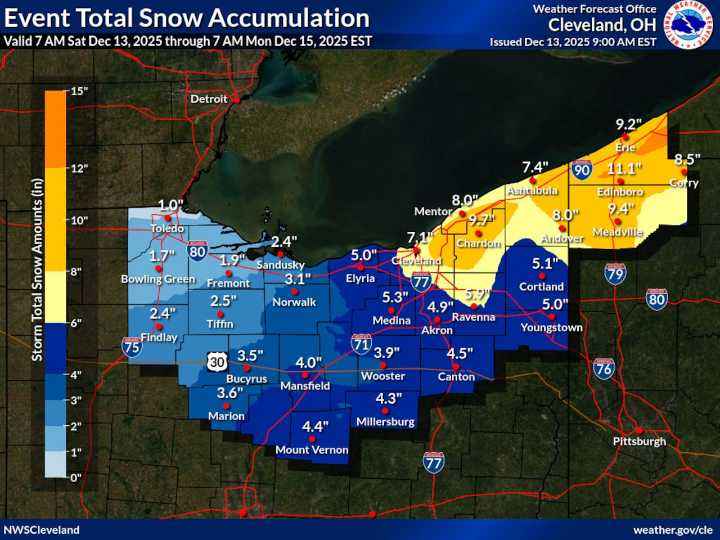
CLEVELAND, Ohio — A double-headed wintry weekend is underway across Northeast Ohio, which could impact travel and holiday season plans throughout the region.
A fast-moving clipper system will bring widespread accumulating snow Saturday, followed by intensifying lake-effect snow and dangerous cold into Sunday.
Most communities will see 1 to 4 inches of snow from Saturday’s system, with the highest totals expected along and south of the U.S. 30 corridor between Mansfield, Wooster and Canton, according to the National Weather Service in Cleveland .
In the snowbelt, lake-effect snow will add significantly more, with totals of 5 to 10 inches expected through Sunday night and higher amounts possible in the higher terrain east of Cleveland.
A lake-effect snow warning is in effect for Cuya

 Cleveland 19 News
 Cleveland Jewish News
 News 5 Cleveland
 CNN Politics
 Mediaite
 America News
 The Travel