
 Northwest Arkansas Democrat-Gazette
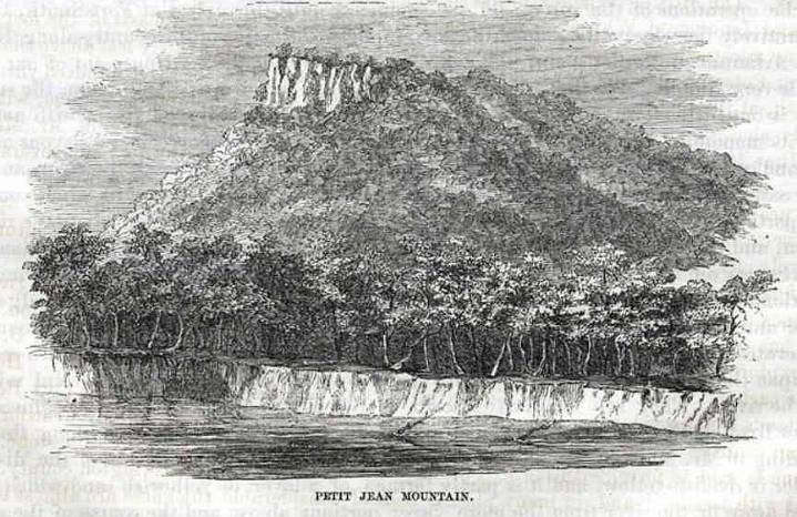
Petit Jean Mountain is the name commonly given to the large mesa on the south bank of the Arkansas River in Conway County. It is part of the Arkansas Valley, one of the six natural divisions of Arkansas, and the home of Petit Jean State Park.
A relatively flat top gives Petit Jean elevations that vary from approximately 750 feet above sea level to a high point of 1,207 feet above sea level. Shaped roughly like a bird's head, the mountaintop stretches about 5.5 miles from east to west and 2.6 miles from north to south. At Cedar Falls, the creek tumbles off a 70-foot precipice and then meanders through Cedar Creek Canyon into the Petit Jean River to the west.
Evidence of Native American occupation of the mountain extends back some 10,000 years, and the mountain boasts nearly 100 documented

 CBS News
 The Conversation
 New York Post Lifestyle
 KTVH
KTVH K2 Radio Local
 Associated Press US and World News Video
 Great Bend Tribune
 New York Post
 Associated Press Top News
 The Babylon Bee