
SARASOTA, Fla. (WWSB) - One of the first big plumes of Saharan dust has made its away across the Atlantic, and is now settling in overhead. This will keep the upper atmosphere dry for the weekend, limiting chances for thunderstorms across the state. A ridge of high pressure has also moved in from the east, and its axis has established itself just to our south. The result is southwesterly wind across the Suncoast through the weekend, so any showers that do develop will be pushed inland and away from the coast. Scattered late morning and early afternoon showers are possible, but they will be fleeting. 10% chance of rain on Saturday, then 20% on Sunday, with mostly clear skies allowing highs around 90. We will still have plenty of humidity, and heat indices will be close to 100 through the we
Hot, sunny weekend ahead
 WWSB14 hrs ago
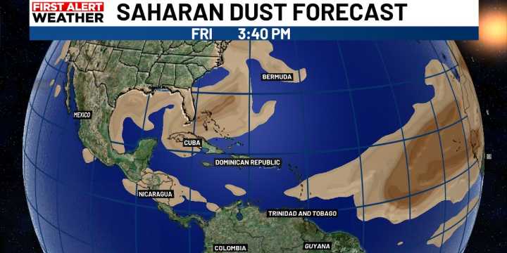
280

 WGNO
WGNO WCCB Charlotte
 KRIS 6 News Weather
 KX News Politics
 The Hill Politics
 FOX News Politics