
In the last 24 hours, we've seen scattered rain showers and thunderstorms creating a few isolated high water issues as we start our weekend and the action will linger today. We have a marginal and slight risk for severe thunderstorms later today. Most of the strong storm potential will sit over southern KY with the main threats of flooding and a few damaging wind bursts. It will not be raining all day, but you may need the umbrella and a backup plan for any outdoor activities. Sunday will be slightly calmer as we see only a chance for isolated thundershowers. The storm activity will linger into Monday before we dry out for mid week. The temperature trend will remain warm...around or just above normal for several more days.
Scattered thunderstorms through the weekend
 LEX 18 News14 hrs ago
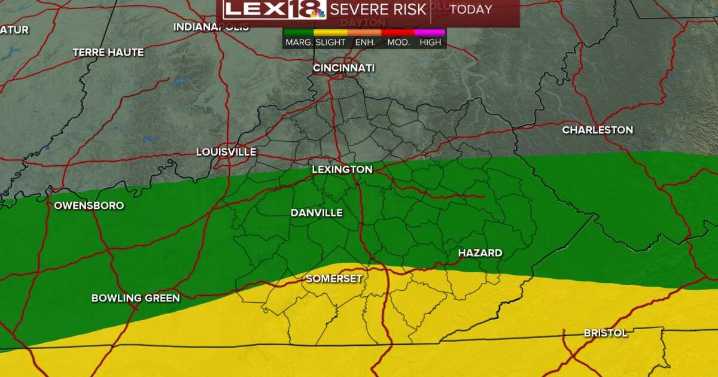
40

 NBC Connecticut
 WWLP
WWLP WAVE 3 News
 Page Six
 New York Post
 Oh No They Didn't
 The Washington Post World
 TheWrap