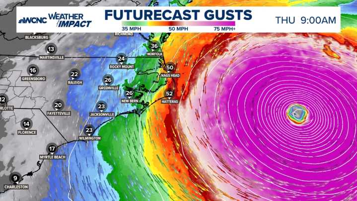
CHARLOTTE, N.C. — Hurricane Erin went through extreme rapid intensification on Saturday, making it a Category 5 hurricane with maximum winds of 160 mph at peak intensity. This was actually one of the quickest rapid intensifications on record and the earliest to gain 85 mph in recorded history.
As of the Wednesday update, Hurricane Erin is a strong Category 2 hurricane with sustained winds of 110 mph. Erin will continue to march north and eventually northeast over the next two days.
Although the Outer Banks have indirect impacts, we are very grateful the storm will be steered away from the East Coast. High waves and an elevated rip current risk remains through Friday with the strong wind gusts (45 - 55 mph) early Thursday.
Carolina Impacts • Wind gusts up to 55 mph for the Outer Banks

 WCNC Charlotte Weather

 The Weather Channel
 WAND TV
 CBS Mornings
 ABC News
 The Babylon Bee
 Raw Story
 America News