
 The Oregonian Public Safety
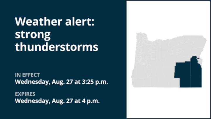
A report from the National Weather Service was issued on Wednesday at 3:25 p.m. for strong thunderstorms until 4 p.m. for Harney and Malheur counties.
The storms are foreseen to bring wind gusts of up to 40 mph and marble-sized hail (0.5 inches).
"At 3:25 p.m., Doppler radar tracked a strong thunderstorm near Juntura, or 47 miles east of Burns, moving southeast at 15 mph," says the weather service. "Gusty winds could knock down tree limbs and blow around unsecured objects. Areas of blowing dust possible. Minor damage to outdoor objects is possible."
Expect strong thunderstorms in Juntura around 3:30 p.m.
The weather service states, "If outdoors, consider seeking shelter inside a building. Torrential rainfall is also occurring with this storm and may lead to localized flooding. Do not d

 WCNC Charlotte Weather
 Greensboro News and Record
 Florida Today
 The Washington Post
 FOX Weather
 Ann Arbor News
 Rockford Register Star
 KSL Utah
 Gizmodo
 RadarOnline