
It's a good idea to throw on light and loose clothing, grab your sunglasses, pack extra water, and be prepared for more active weather as you get ready to head out the door Tuesday. High pressure off the coast will continue to drive above average high temperatures, and low pressure across the West Coast will draw in enough moisture to drive enough instability to kick off more thunderstorm activity today. A Red Flag Warning for high fire danger has been issued for areas of Modoc, Siskiyou and Trinity Counties from 1pm through 9pm Tuesday due to the threat of lightning sparked fires. A Flood Watch has been issued for areas of Lassen and Plumas Counties from noon through 9pm Tuesday due to the potential for heavy rainfall from thunderstorms that could drive mudslides and debris flows around r
Storm Tracker Forecast: Still toasty with more thunderstorms likely Tuesday
 Action News Now08/26
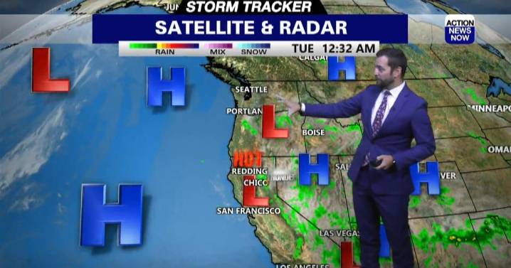
14

 Local News in New York
 People Human Interest
 KRIS 6 News Weather
 FOX 10 Phoenix National
 KPTV Fox 12 Oregon
 FOX 5 Atlanta Crime
 New York Post