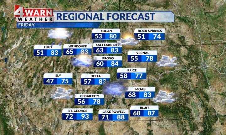
SALT LAKE CITY (ABC4) - Happy Friday, Utah! We've had an ongoing monsoon surge this week, but as we close out the work week the chances of precipitation are dwindling as a warming and drying trend set up for Labor Day weekend. A brief surge of moisture overnight and this morning impacted southern and eastern Utah as tropical moisture from post Tropical Cyclone Juliette got caught up in our southwesterly flow. Since that's cleared, we have a drier airmass overhead and a touch of lingering moisture that could allow for an isolated pop-up storm today. Other than that, you can expect partly cloudy to mostly sunny skies throughout the state.
While temperatures have been running below average, a warming trend is underway with numbers getting to average and then above seasonal norms by Labor Day

 ABC4 News

 Local News in Florida
 Ocala Star-Banner
 Cache Valley Daily
 FOX 5 Atlanta Crime
 Columbia Daily Tribune
 Battle Creek Enquirer
 Corpus Christi Caller-Times
 FOX 32 Chicago
 Fox 11 Los Angeles Sports