
 WMAR-2 News
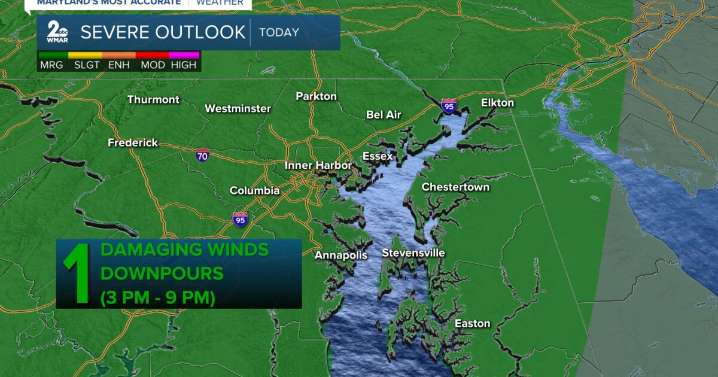
BALTIMORE — Happy Thursday! A cold front will bring showers and storms to the area around mid-afternoon through the mid-evening (3-9 PM). Isolated storms may produce damaging wind gusts and even some downpours, so keep an eye on radar if you have outdoor plans today. Temperatures will warm up into the mid to upper-80s late-week with an uptick in the humidity. mostly dry on Friday before another disturbance swings through on Saturday, which will generate some thunderstorms during the afternoon and evening. Behind the series of cold fronts, a drier and fall-like air mass will follow. This will keep temperatures in the mid-70s from Sunday through the middle of next week!
WMAR
A chance of showers and thunderstorms. Sunny, with a high near 86. South wind 8-18 mph, with gusts as high as 25-30

 FOX Baltimore
 The Baltimore Sun
 WUSA 9 Maryland
 WJZ CBS Baltimore
 America News
 LiveNOW from FOX Politics
 6abc Action News Politics
 Mediaite
 The Babylon Bee
 The List