
 CBS News
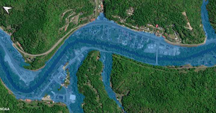
A mapping tool that aims to provide forecasters and communities with flooding information has expanded to cover 60% of the U.S. population, the National Weather Service announced Thursday. With this development, the experimental tool promises to serve twice as many Americans as it did before.
The Flood Inundation Mapping, or FIM , tool is designed to show Google Earth-like visualizations of flood waters as they are either impacting, or forecasted to impact, neighborhoods across the country, according to the National Oceanic and Atmospheric Administration, or NOAA. NOAA is the federal parent agency of the Weather Service, which is a primary source of weather forecasts during emergencies, including floods.
The interactive, online tool allows people to learn more about flood forecasts o

 America News
 Associated Press US News
 AccuWeather Severe Weather
 TownTimes news.com
 NBC News
 Reuters US Top
 Raw Story
 NBC Southern California Entertainment