
 WKYT
WKYT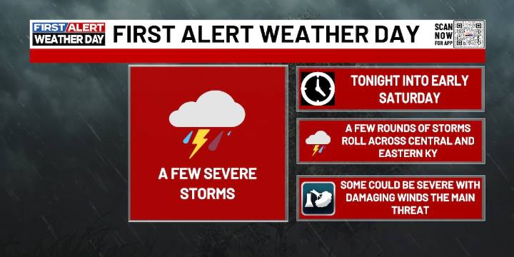
LEXINGTON, Ky. (WKYT) - It’s a FIRST ALERT WEATHER DAY as a major fall front crosses the region tonight, creating a few severe storms, then we cool down for the weekend.
Scattered showers and thunderstorms will be with us this evening. A few storms may be severe with damaging winds, large hail, and even an isolated tornado. These scattered showers and storms will continue early into the overnight before temperatures fall into the mid to upper 50s for lows.
Saturday will be a much cooler day as we see cloudy skies and some rain at times, especially in the late morning and early afternoon. Highs will be much lower as they only reach the mid to upper 60s. Skies will start to clear Saturday evening into Saturday night as temperatures fall into the mid to upper 40s for lows.
Sunday will be

 WBKO
WBKO Courier Journal
 CBS News
 NewsTalk 1280
 WNKY
WNKY WAVE 3 News
 New York Post