
 WBKO
WBKO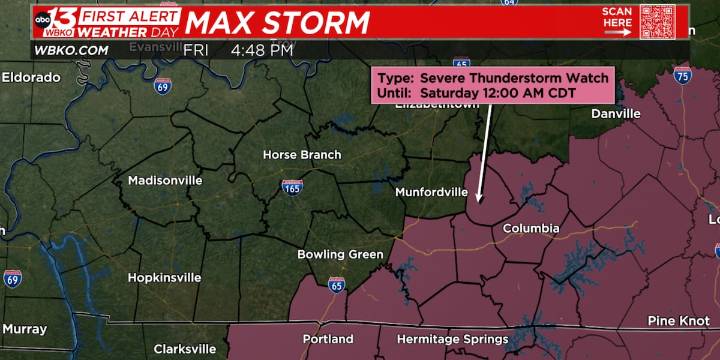
BOWLING GREEN, Ky. (WBKO) - Scattered storms will continue to develop into the evening. Storms are more likely to develop along and ahead of the cold front, which is situated from roughly Adairville to Bowling Green, all the way through Columbia. A few of these storms could be severe with the main risk being strong winds and isolated hail. Tornadoes are not expected. Scattered storms will continue, especially for areas east and southeast of the cold front, through about 10 pm. Cooler air is going to continue to funnel in from the northwest.
WEEKEND OUTLOOK: Some more rain showers are likely later tonight and into Saturday morning. During the afternoon clouds will slowly clear out as drier air continues to move in. Highs on Saturday will only be in the lower 70s. More sunshine and comfort

 Charleston Gazette
 Tucson News Now
 WKOW 27
 Corpus Christi Caller-Times
 FOX Weather
 The Weather Channel
 New York Post
 NewsTalk 1280
 10 Tampa Bay
 KTAL-TV
 The Week