
 Cleveland 19 News
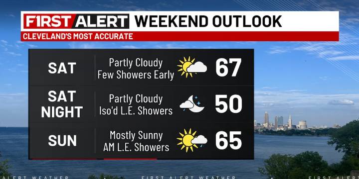
CLEVELAND, Ohio (WOIO) - After a cold front crossed the region Friday evening, fall-like temperatures are back for the weekend.
A few showers early this morning will give way to drier conditions for the afternoon under a partly cloudy sky.
High temperatures rise to the upper 60s with a west wind between 10 and 20 mph.
From tonight into Sunday morning, there is the potential for a few lake-effect showers, primarily in the “snowbelt” zone.
Temperatures level out near 50 degrees overnight. Download the 19 First Alert Weather App
Most lake-effect rain winds down Sunday afternoon, so while there may be a stray shower at the start of the Browns game at 1 p.m., much of the game is looking dry and sunny.
However, it remains cool as high temperatures only reach the mid to upper 60s Sunday af

 Essentiallysports Tennis
 America News
 Local News in California
 Reuters US Domestic
 Slate Politics