
 7News Boston WHDH
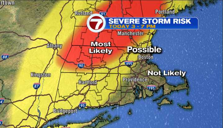
We haven’t had much in the way of severe weather this summer in southern New England which makes sense given how dry the pattern has been but today is different. It’s warm and muggy and we have ingredients in the atmosphere (strong wind and lift) that will likely produce scattered strong to severe t-storms later today. The mechanism that will “lift” the warm/humid air up into the atmosphere is a cold front which is located across eastern New York state late this morning:
Once the warm/humid air gets hoisted up into the sky it (the rising air) will then interact with the strong jet stream wind to produce strong to severe storms. Interior New England looks like the area most likely to see strong/severe storms:
Understand that not everyone will see severe storms in that red blob….rather, mo

 Newsday
 New York Post
 KRWG Public Media
 Detroit News
 The Babylon Bee
 Mid-Hudson News
 MovieWeb