
 SIAdvance
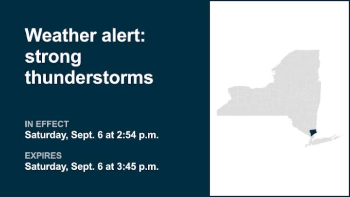
A report from the National Weather Service was issued on Saturday at 2:54 p.m. for strong thunderstorms until 3:45 p.m. for Westchester County.
The storms are packing wind gusts of up to 50 mph and pea-sized hail (0.25 inches).
"At 2:53 p.m., Doppler radar tracked a strong thunderstorm near Bedford, or near Mount Kisco, moving northeast at 40 mph," states the weather service. "Gusty winds could knock down tree limbs and blow around unsecured objects. Minor hail damage to outdoor objects is possible."
Locations impacted by the alert include Waterbury, Danbury, Shelton, Naugatuck, Southbury, Newtown, Hamden, Ridgefield, Monroe, Bethel, Wilton, Seymour, Brookfield, Derby and Prospect.
The weather service states, "If outdoors, consider seeking shelter inside a building. A Severe Thundersto

 Local News in New York
 NECN Providence
 KPTV Fox 12 Oregon
 The Washington Post
 FOX 5 Atlanta Crime
 WTOP
WTOP FOX Weather
 KSNB Local4 Central Nebraska
 FOX 10 Phoenix National