
 KIMT News 3
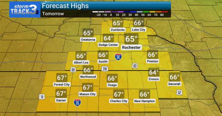
After another cool/cold night tonight with some patchy frost possible, Sunday is shaping up to be a much nicer day, with mainly sunny skies and highs climbing a bit to the mid-60s. While it's an outside chance, there is a slim risk of some patchy frost in spots tonight and again on Sunday night, especially in those areas where skies clear out and winds become light.
The pattern begins to shift early next week. By Monday, we'll start to see more cloud cover build in, and by Monday night into Tuesday, we're bringing back a decent chance for showers and perhaps even a few thunderstorms, with those chances increasing to 50-60%. Temperatures will start to bump up, reaching into the upper 60s and low 70s early week. However, highs return to the mid-to-upper 70s by Wednesday and Thursday.

 Local News in New York
 KSNB Local4 Central Nebraska
 KRIS 6 News Weather
 FOX Weather
 Arizona's Family
 The Washington Post
 New Jersey News
 El Paso Times
 KWQC
KWQC America News