
 CBS Philly
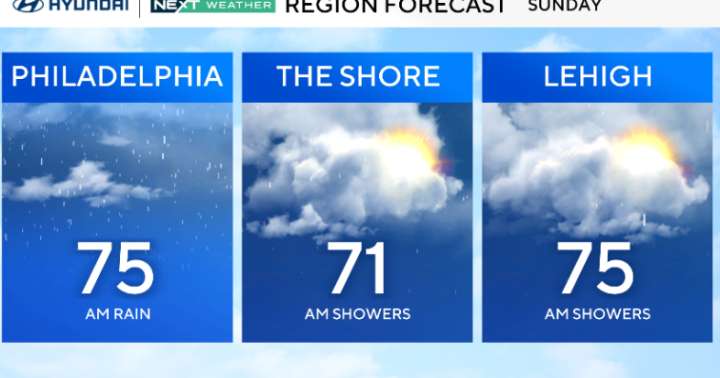
There is no longer a severe thunderstorm watch in effect, but showers will continue into Sunday.
At this point, the only weather threat left on the table is flash flooding, mainly in spots that have already seen a lot of rain.
A few areas southeast of I-95 could still pick up an inch or two overnight, so low-lying neighborhoods and poor drainage spots are worth keeping an eye on.
CBS News Philadelphia.
Through Sunday, clouds will hang tough, and so will a few lingering showers, especially in the morning. As the day wears on, the system will finally push east and allow drier air to filter in.
With the cooler air mass behind the front, highs will be knocked back into the low and mid-70s. It'll feel noticeably different compared to the warm, humid stretch we just had.
CBS News Phila
 WFIN News
 WTAJ-TV
 WTAE-TV Pittsburgh
 Akron Beacon Journal
 The US Sun Latest
 KETV Sports
 CBC News World
 NBC News
 TMZ
TMZ