
 News4JAX
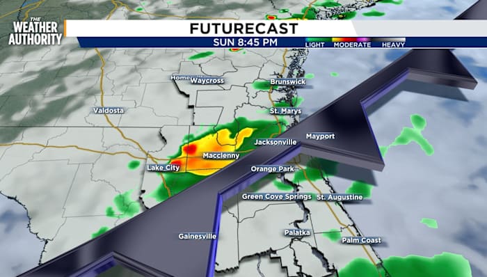
CURRENT WEATHER HAZARDS
Strong thunderstorms are appearing on radar and are a concern through 6 PM
COUNTIES: NORTHWESTERN FLAGLER...SOUTHWESTERN ST. JOHNS...NORTHEASTERN PUTNAM AND SOUTHEASTERN CLAY COUNTIES, SOUTHERN GILCHRIST AND WESTERN ALACHUA COUNTIES, NORTHWESTERN FLAGLER...SOUTHCENTRAL ST. JOHNS AND SOUTHEASTERN PUTNAM COUNTIES
SUNDAY EVENING FORECAST
As the front approaches SE Georgia and NE Florida, more storms and rain will continue through sunset.
There will be rounds of isolated to scattered storms through sunset. Some isolated severe storms are possible with strong winds and heavy downpours. The greatest chance for storms is along, I-95, the coast, and Saint Johns River Basin.
RAIN ACCUMULATION THROUGH SUNDAY 11:59 pm
Temperatures will drop into the mid-70s by midnight
 The Washington Post
 Ocala Star-Banner
 WRAL News
 WFTV Channel 9
 FOX 5 Atlanta Crime
 WCBI-TV
 FOX 5 Atlanta
 Mason City Globe Gazette
 KSNB Local4 Central Nebraska
 Raw Story