
 FOX Weather
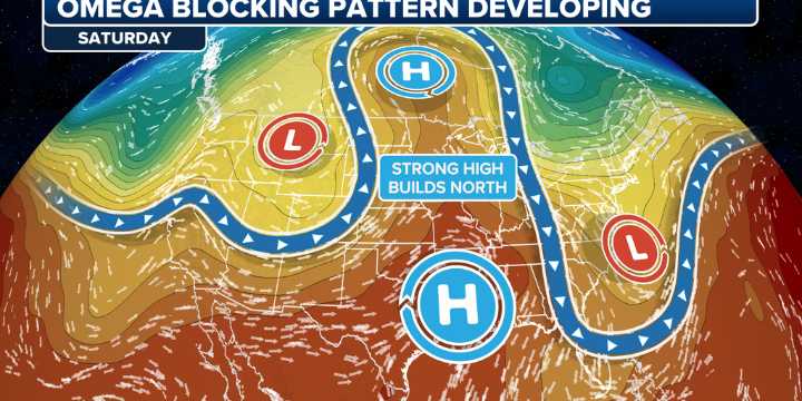
NEW YORK – After a couple of weeks under a stagnant weather pattern, things are finally shaking up across the continental U.S. as an Omega Block weather pattern will bring summer temperatures roaring back across the heartland, in addition to much-needed rain for the Pacific Northwest .
An Omega Block refers to dips in the jet stream where a large area of high pressure is bookended by two areas of low pressure, causing the pattern to resemble the Greek letter Omega (Ω) on a weather map.
This particular Omega Block will begin to develop tomorrow as high pressure finally returns to the central U.S., sending temperatures into the 90s and an area of low pressure brings more intense storms to the Pacific Northwest, which is experiencing one of its top-10 warmest and driest summers on record.

 Los Angeles Times Business
 ABC11 WTVD Politics