
 WRCB-TV
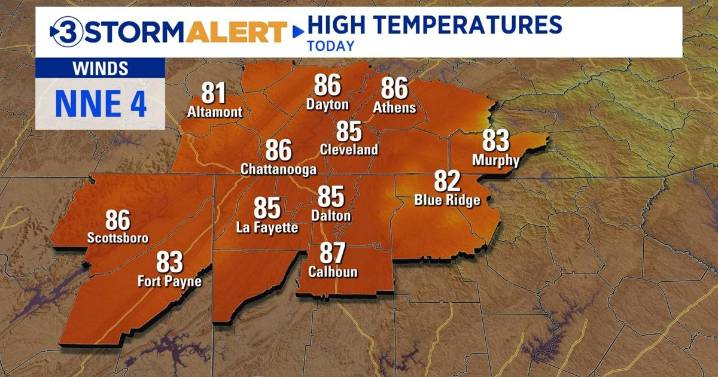
Good morning! It’s another comfortable start to the day with temperatures ranging from the 50s to the lower 60s. Highs will bounce back into the mid 80s, similar to what we had on Wednesday. A weak system will swing through from the northwest, increasing cloud cover during the afternoon. There will be a slim chance of a rain shower, mainly in areas along the Cumberland Plateau. More than likely, we will all stay dry today.
Friday and Saturday will be nearly identical, with plenty of sunshine and highs ranging from the mid to upper 80s. After a week of highs in the 80s, temperatures are expected to return to the 90s on Sunday. 90-degree heat will continue into early next week as high pressure builds to our west. Summer isn’t done just yet!
Rain chances are slim to none over the next 7 day

 NECN Providence
 NOLA
NOLA AccuWeather Severe Weather
 Shelby Star
 KPTV Fox 12 Oregon
 The Baltimore Sun
 Lodi News Stockton
 FOX 5 Atlanta Crime
 The Oregonian Public Safety
 IMDb TV