
 21Alive News
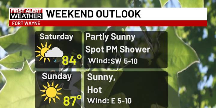
FORT WAYNE, Ind. (WPTA) - A nearby stationary front will fling some clouds our way Saturday morning and afternoon, as well as perhaps a few showers west of Fort Wayne (and likely even as far west as Wabash/Huntington counties). This will keep temperatures cooler through the afternoon (70s), but clearing later in the day will likely get us into the low to mid 80s.
Sunday will be quite hot for mid September with highs in the upper 80s, and this heat will linger through at least Thursday of next week.
By next Friday, highs could cool back into the low 80s as a front nears the region.
Meanwhile, still no signs of heavy rain within the next seven days.

 Reuters US Top
 Chicago Tribune Crime
 The Babylon Bee
 People Pets
 The Shaw Local News Sports
 The Week Politics
 Raw Story
 Mediaite