
 KFVS12
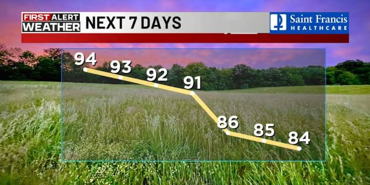
(KFVS) - Hot, summer-like conditions will continue for the next few days before a moderating trend arrives by the end of the week.
Today will be another unusually hot September day with highs ranging from 92 to 96 degrees.
Dew points look to remain in the 60 to 65 degree range, which will push the heat index just above the actual air temperatures.
An isolated afternoon thunderstorm is possible again, mostly over the hills of southeast Missouri, especially along and west of U.S. 67.
Little change is expected for Tuesday and Wednesday, as hot conditions continue and the drought intensifies.
Burn bans and no-burn advisories have been issued throughout the Heartland because of extremely dry conditions.
The upper ridge pattern will finally start to break down by the end of the week, allo

 WCBI-TV
 The Star Press
 News 8 WROC
 The Washington Post
 Hawaii News Now
 FOX Weather
 The Columbian
 WSIL-TV
 Florida Today
 KTVB 7
 AlterNet