
 WSIL-TV
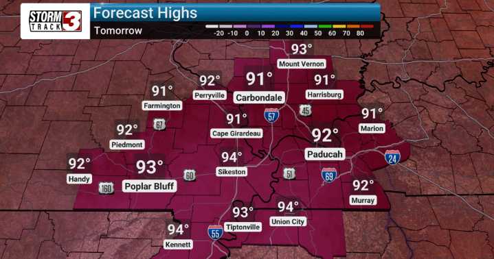
We're looking at a prolonged period of significant warmth across Southern Illinois and points in the Ohio Valley. We are tracking high temperatures that will be running 7 to 10 degrees above normal, pushing into the middle and upper 90s from today through Wednesday. The "feels like" temperatures will be keeping pace with the actual air temperatures, likely staying in the mid to upper 90s.
As we move through today and into tonight, we're forecasting a stray shower and thunderstorm to develop. The coverage looks to be hit or miss, meaning some areas might catch a downpour while others stay dry. Looking ahead past Wednesday, the forecast models start to show a shift. We anticipate increasing chances for rain later in the week, specifically Thursday into Friday, as more active weather pattern

 WCBI-TV
 The Washington Post
 The Columbian
 KETV NewsWatch 7
 WITN-TV
 Hawaii News Now
 21Alive News
 FOX Weather
 Raw Story
 YourTango Horoscope