
 ABC4 News
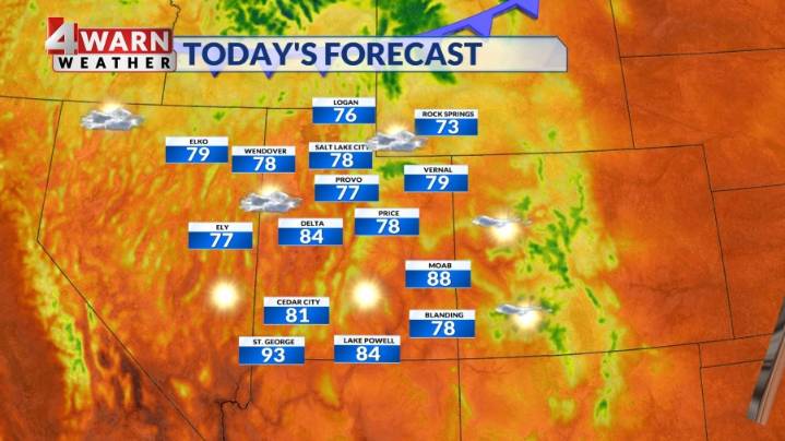
SALT LAKE CITY (ABC4) — Happy Monday, Utah! A weak disturbance will approach northern Utah on Monday, bringing an isolated thunderstorm or two to portions of the area. The best chance for picking up an isolated shower or storm will be across portions of Cache Valley, the Ogden Valley, Uintas, and SW Wyoming. We may see a stray shower drop as far south as portions of the Wasatch Front Monday afternoon. High temperatures will climb into the upper 70s for northern Utah, and in the low to mid 90s for SW Utah. The southern portions of the state will stick with plenty of sunshine to kick off the new week.
Isolated to scattered thunderstorms will be possible over the far NE mountains on Tuesday, but most of the state will once again begin to dry out. Highs will be near 80 along the Wasatch Front

 Associated Press US News
 CNN Politics
 Edmonton Sun World
 Raw Story
 CBS News
 Blaze Media